Aberdeen Airport (ABZ)
Driving Directions / Travel by Car
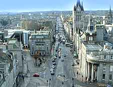
(Aberdeen, Aberdeenshire, Scotland, UK)
Serving eastern Scotland, Aberdeen Airport (ABZ) is located around 15 minutes to the north-west of the city centre and is situated alongside the main Aberdeen to Inverness road, the A96 (Auchmill Road / Great Northern Road). Aberdeen Airport is also close to Cothall, Drumligair and Overton, all of which are located to the north.
Forties Road and Brent Road lie to the west, while Victoria Street edges the eastern side of the airport and heads in a southerly direction, passing the Wellheads Industrial Estate, Stoneywood and Bankhead along the way. On the southern side of the airport you will find Craibstone, the Chapel of Stoneywood and Bucksburn.
Directions to Aberdeen Airport (ABZ) from the north of Scotland:
- From the Inverness area, take the A96 and head south-east towards Aberdeen
- Around 11 km / 7 miles before the city, turn left on a heading north along Dyce Drive, which leads directly to the airport
Directions to Aberdeen Airport (ABZ) from the south of Scotland:
- Take the M90 due north from Edinburgh to Perth
- Head north-east from Perth and join with the A90 Aberdeen Road
- Bypass Aberdeen on the A90, which meets with the A96 Inverness Road
- Continue on the A96 before turning right onto Dyce Drive, which leads to the airport
Directions to Aberdeen Airport (ABZ) from the west of the UK:
- From Glasgow, take the M8 motorway to Edinburgh before following the above south directions
- From Fort William, head north to Inverness before taking the A96 to the passenger terminal
During rush hour times, the M8 Glasgow to Edinburgh motorway can become fairly congested, as can the M90 Edinburgh to Perth stretch.
Aberdeen Airport (ABZ): Virtual Google Maps
